Aaron Putnam sits atop a boulder high in the Sierras of central California, banging away with hammer and chisel to chip out a sample of ice age history. Each hunk of rock is a piece of a vast puzzle: How did our climate system behave the last time it warmed up like it’s doing today?
More than 85 percent of the ocean floor remains unmapped, leaving us in the dark about much of the earth’s topography. A global, non-profit effort will try to remedy that by 2030. The effort will affect everything from climate research and weather prediction to mineral resource exploration and fisheries.
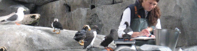
After record-setting warmth this year, winter is upon us. That means it’s summer in Antarctica, and the Earth Institute has scientists camped there working on two projects that will help us understand what’s going on in this climate-changing world.
Margie Turrin of the Lamont-Doherty Earth Observatory is filing dispatches and stunning photos from the IceBridge project. Researchers are studying polar ice (a similar program operates in northern summers in Greenland). Flying back and forth across the Antarctic Peninsula, they’re using sensitive instruments to measure the stability of the ice sheets and the tongues of ice shelves that stretch out over the ocean. A second team working on the ROSETTA project is looking at sea temperature and its effects on the Ross Ice Shelf.
Meanwhile, back in the northern hemisphere, the Arctic has been warming twice as fast as the global average, with impacts that will reach far beyond the far north. The melting season in some areas of Greenland is 30 to 40 days longer than in recent decades, said Lamont scientist Marco Tedesco, who helped write the National Oceanic and Atmospheric Administration’s 2016 Arctic Report Card. The report was presented this week at the fall meeting of the American Geophysical Union. (For more on that key meeting of scientists and the Earth Institute’s role, look here.)
“In other places, going from 75 F to 80 F might not make such a great difference,” Tedesco told NPR. “But if you cross the melting point, you are basically stepping into a completely new world.”
A new initiative aims to help homeowners in New Jersey cope with arsenic contamination in private wells—a problem that has only come to light in recent years, and about which many homeowners are still unaware.
In a series of fact sheets and student-produced videos, the project provides important information about the problem to help homeowners understand what may be going on, and how to clean up their water. To watch the videos and read up on the problem, go to the New Jersey Arsenic Awareness Initiative website.
An animation created by Vicki Ferrini of the Lamont-Doherty Earth Observatory of the topography of a new island formed by an explosive volcano in the southwestern Pacific.
One of the earth’s newest islands exploded into view from the bottom of the southwest Pacific Ocean in January 2015, and scientists sailing around the volcano this spring have created a detailed map of its topography. You can see an animation of the volcano, mostly underwater, by clicking on the above image.
Groundwater pumping for agriculture and other uses has risen sharply. But a new study says it isn’t contributing as much as previously thought to sea level rise.
Some research suggests that, along with melting ice sheets and glaciers, the water pumped from underground for irrigation and other uses, on the rise worldwide, could contribute substantially to rising sea levels over the next 50 years. A new study published in Nature Climate Change says the magnitude is much lower than previously estimated.
Vicki Ferrini has spent a lot of time working on mapping the ocean floor, and now she’s sailing in the South Pacific to get a closer look.
Ferrini, who works in the Marine Geology and Geophysics Division of the Lamont-Doherty Earth Observatory, is sailing aboard the Schmidt Ocean Institute’s R/V Falkor. Scientists aboard the research vessel are exploring the life around hydrothermal vent systems 2,400 meters beneath the surface of the South Pacific Ocean. And, they’re blogging about it.
Ferrini posted the latest dispatch at the American Geophysical Union website. The ship is hovering over the Lau Back-arc Basin, between Tonga and Fiji and next to the Tonga Trench, where the Pacific plate drives under the Australian Plate.
The video above takes you there via some sophisticated mapping to one of the thermal vents that they are studying.
Undersea mountains near the Hawaiian Islands, from the Marine Geoscience Data System. Images of the mountains and nearby seafloor are derived from sonar readings taken along the paths sailed by research ships. (Click on this and the other images for higher resolution.)
The bottom of the ocean just keeps getting better. Or at least more interesting to look at.
In an ongoing project, mappers at Lamont-Doherty Earth Observatory have been gathering data from hundreds of research cruises and turning it all into accessible maps of the ocean floor with resolutions down to 25 meters.
You can see some of the results here, at a mapping site that allows scientists—and you—to zero in on a particular location, zoom in and download topographical maps of the ocean floor. The Lamont data has also contributed to the latest version of Google ocean map, which now offers its own more closely resolved view of the ocean floor globally. (You can take a quick tour of the updated Google map here.)
Three interesting pieces of news about climate change, in case you missed them:
For starters, 2015 is shaping up to be the warmest year on record since 1880, according to new data from the National Oceanic and Atmospheric Administration.
Potential sea level rise in Guilford, CT. Source: Climate Central
Second, if you’re wondering about the longer-term impacts of climate change: Climate Central has produced a startling new, interactive graphic that shows the potential effects of sea level rise, should the world continue to grow warmer, melting more and more of the world’s ice sheets and glaciers. From a general view of the impacts on the United States, you can drill down into the graphic and see what’s likely to happen in your nearest coastal community. You can adjust the scene to see what might happen under various scenarios, should we actually succeed in cutting back carbon emissions.
Translation? My former hometown’s downtown would be pretty much under water, along with a substantial stretch of the Amtrak line running up through coastal Connecticut, by the end of the century. Posted Oct. 14, you can check it out here—just in case you want to plan ahead.
Note: The following story was reported and written in 2007, for The Hartford Courant. Editors there declined to run it. I like the story anyway, and pretty much everything it says has been repeatedly validated by subsequent scientific research. It’s still going on – even in Connecticut. I’ve added a couple of notes in brackets in the text where updates seemed appropriate. — DF
SEWARD, Alaska — The Glacier Express chugged out of Resurrection Bay, and the blowing rain turned to sleet that lashed across the upper deck. White clouds shrouded the dark gray mountains that drop steeply into the sea.
This had been one of Alaska’s coldest and wettest summers. As they headed toward Kenai Fjords National Park, passengers aboard the sightseeing boat, some wrapped in fleece and rain gear in mid-August, had good reason to wonder what had happened to global warming.
But Alaska, frontierland of huge landscapes and volatile weather, is indeed warming. In the past 50 years, the state’s annual average temperature is up as much as 5.5 degrees. Overall, the Arctic region has warmed almost twice as fast as the rest of the world.
The greenhouse gas problem fueled by our crowded and busy civilization affects this remote region now, directly and in many ways — including fading sea ice, melting glaciers, thawing permafrost and changes in habitats that have been the same for thousands of years.
But this is not Alaska’s problem alone. The effects of warming in Alaska and the rest of the Arctic will reverberate all over the globe.